
Plates
Maps & figures
Every map and figure in the volume is registered here with a fixed number, caption, and credit. Attach artwork by URL and it appears immediately in the List of Maps, the List of Figures, and inside the chapter where the plate is placed.
24 of 24 plates have artwork
List of Maps
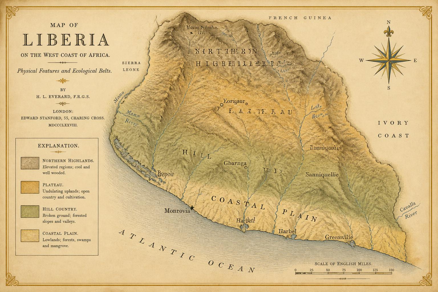
Map 1
Physical Liberia: relief, drainage, and the four ecological belts
Relief and drainage of present-day Liberia, with the coastal plain, hill country, plateau, and northern highlands distinguished. Belt boundaries are gradients, not lines.
Original cartography prepared for this volume.
View in chapter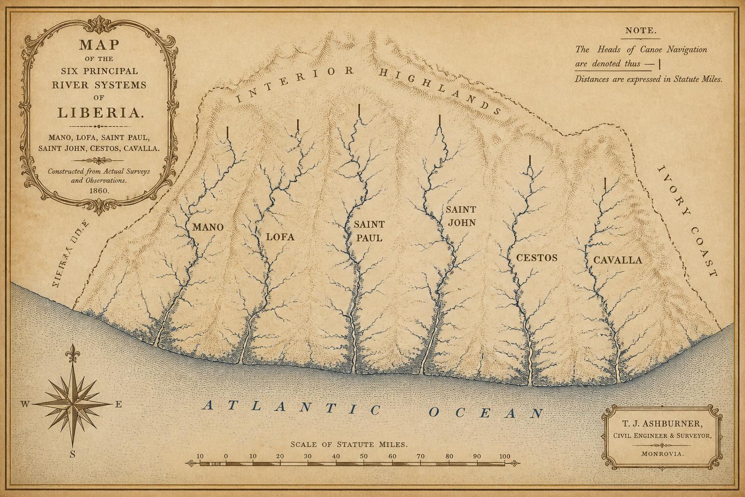
Map 2
The six principal river systems and their navigable reaches
The Mano, Lofa, Saint Paul, Saint John, Cestos, and Cavalla, with the approximate head of canoe navigation on each marked.
Original cartography prepared for this volume.
View in chapter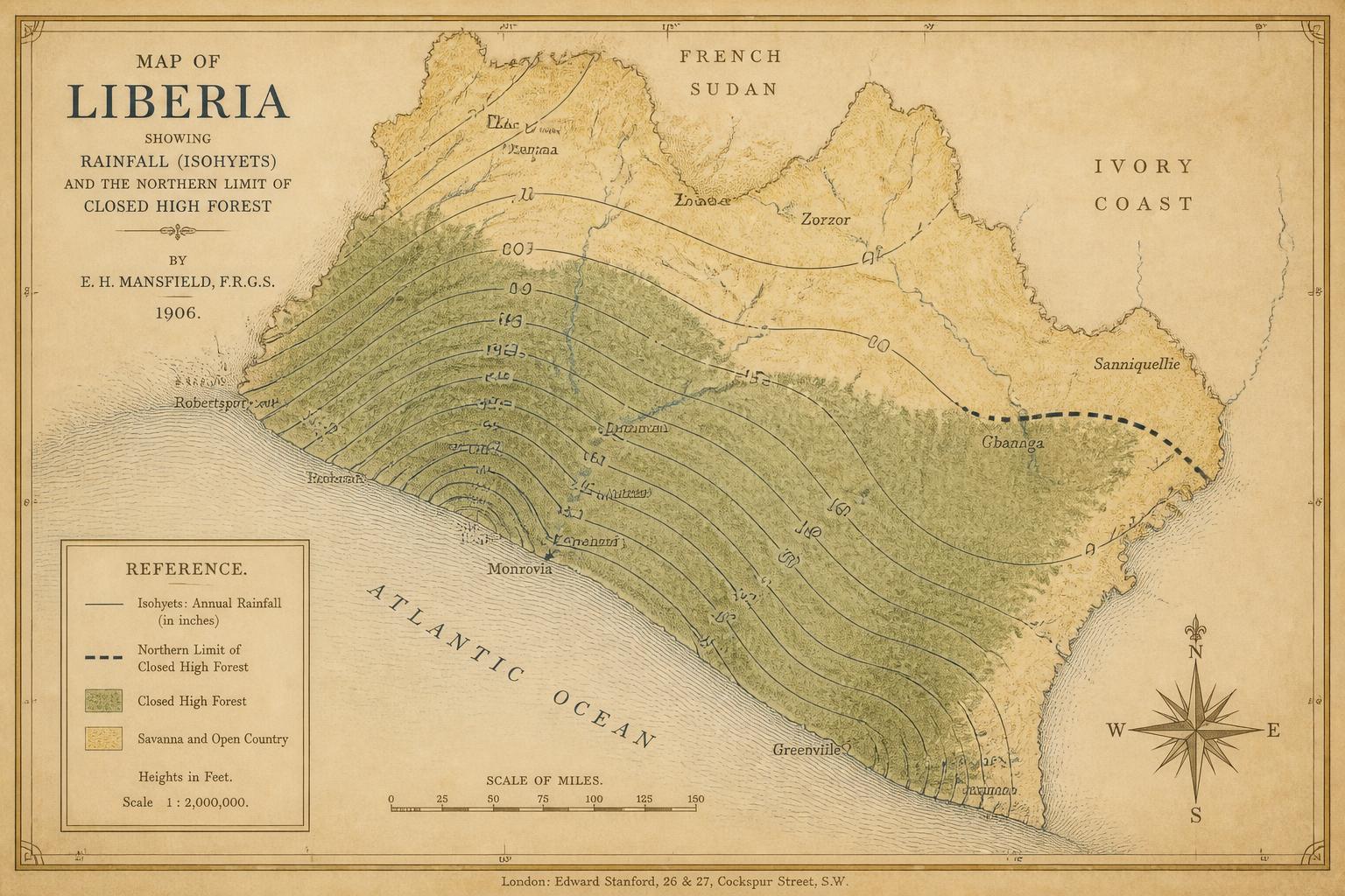
Map 3
Rainfall and the forest–savanna transition
Isohyets of mean annual rainfall against the northern limit of closed high forest.
Original cartography prepared for this volume.
View in chapter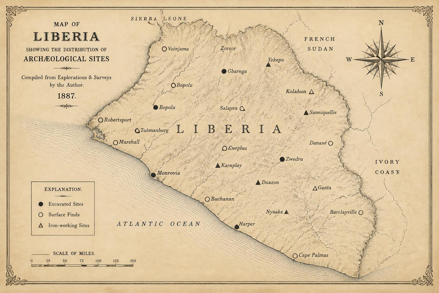
Map 4
Known and probable archaeological sites, Stone Age through Iron Age
Excavated and surface-reported sites. Density reflects survey effort as much as ancient settlement, and should not be read as a distribution map.
Original cartography prepared for this volume.
View in chapter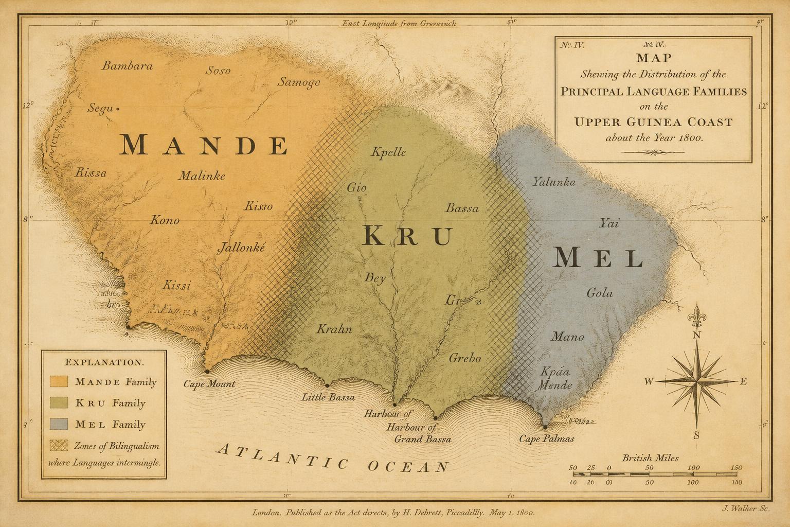
Map 5
Language families of the Upper Guinea Coast: Mande, Kru, and Mel
Approximate distribution of the three families around 1800, with zones of long-standing bilingualism shaded rather than divided.
Original cartography prepared for this volume.
View in chapter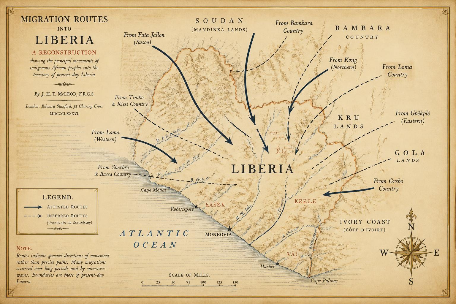
Map 6
Reconstructed migration routes into present-day Liberia
Directional arrows summarising the movements argued for in Chapter 4. Routes are inferences from language, tradition, and terrain, not documented itineraries.
Original cartography prepared for this volume.
View in chapter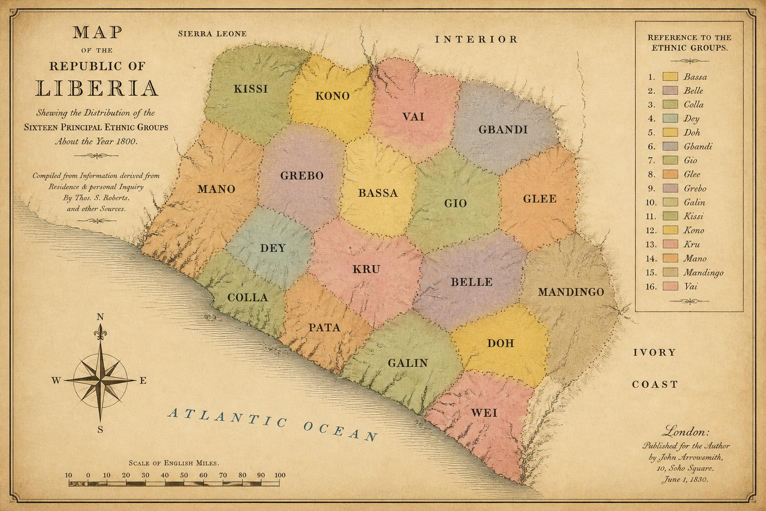
Map 7
Ethnic distribution, approximately 1800
Sixteen principal groups shown at their approximate early-nineteenth-century extents, before the coastal disruptions that followed 1822.
Original cartography prepared for this volume.
View in chapter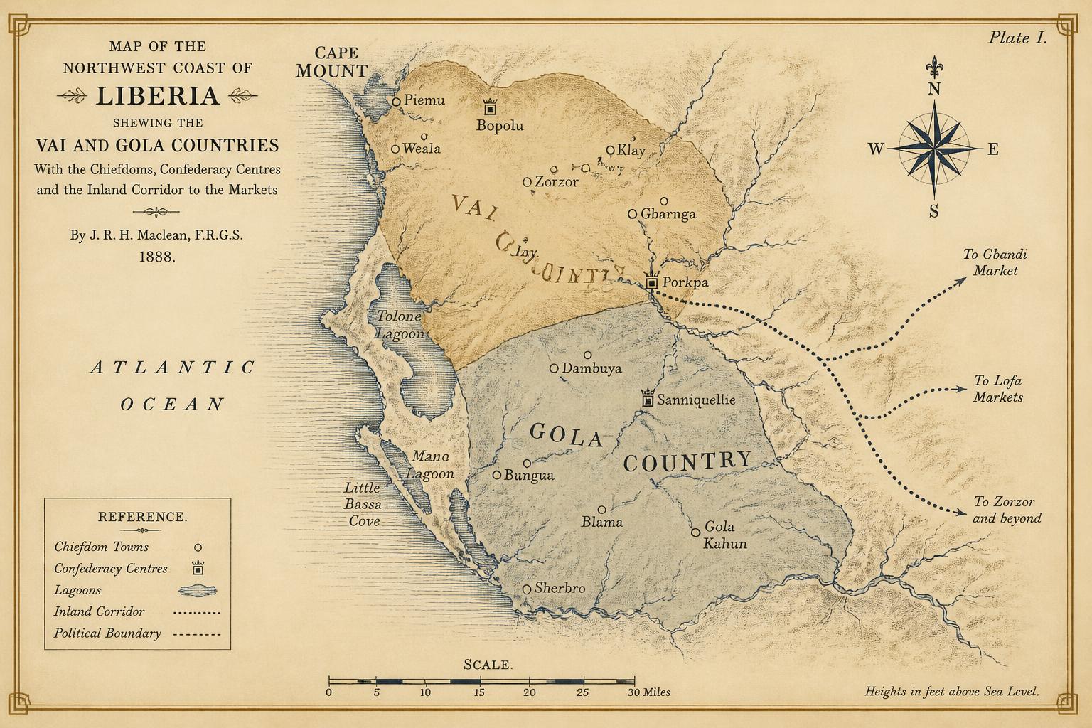
Map 8
Vai and Gola political zones of the northwest coast
Chiefdoms, confederacy centres, and the corridor between the Cape Mount lagoons and the interior markets.
Original cartography prepared for this volume.
View in chapter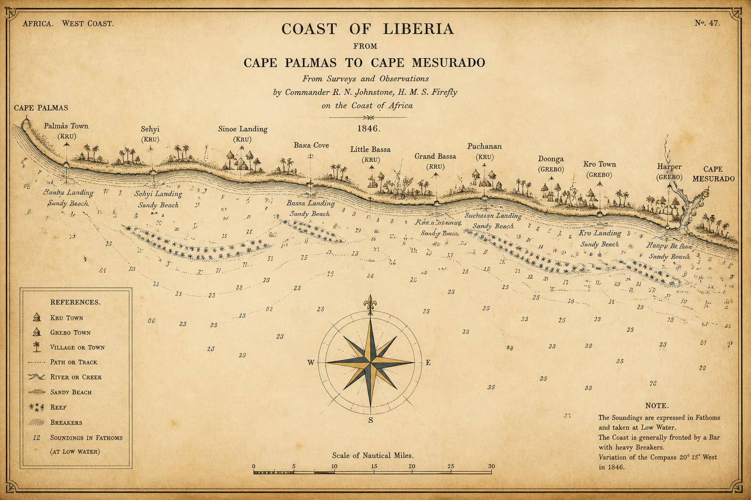
Map 9
Kru and Grebo coastal settlement, Cape Palmas to Cape Mesurado
Named landing beaches, town clusters, and the reefs that governed where a canoe could work the surf.
Original cartography prepared for this volume.
View in chapter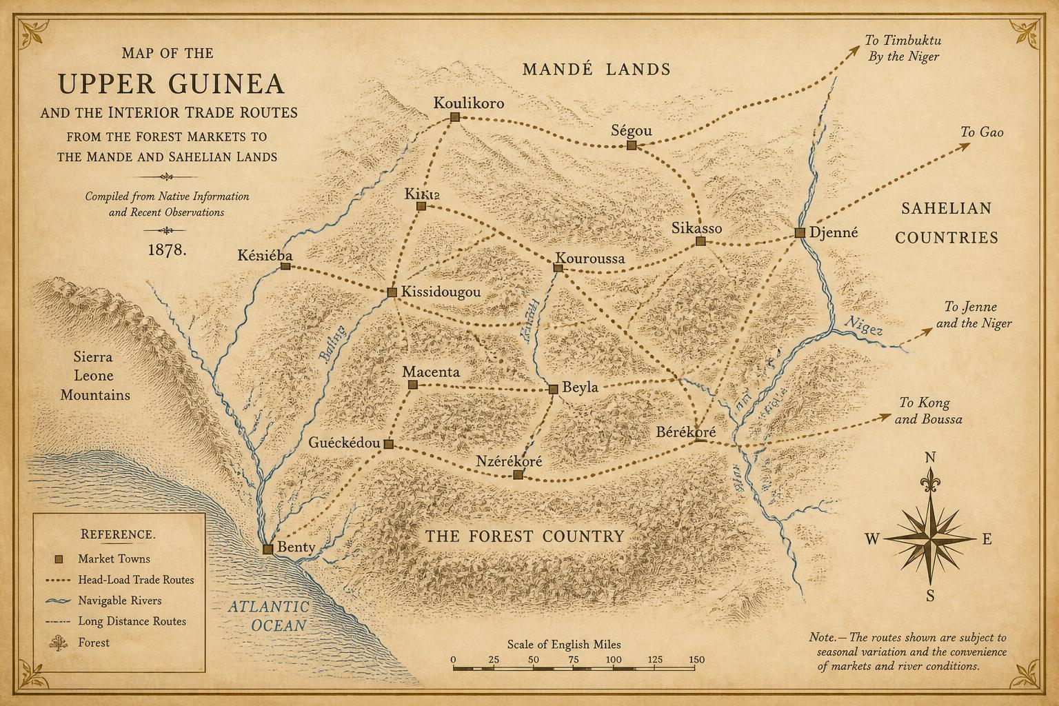
Map 10
Interior trade routes and their connections to the Mande networks
Head-load paths, river reaches, and the market towns where the coastal and Sahelian systems met.
Original cartography prepared for this volume.
View in chapter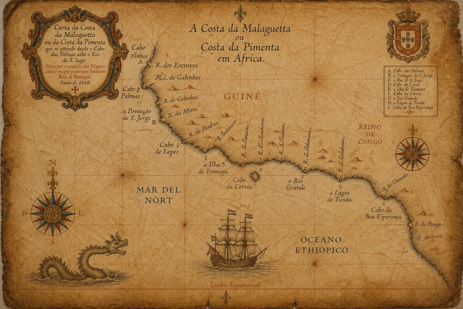
Map 11
The Malaguetta or Pepper Coast as charted by European mariners, 1460–1700
Composite of coastal outlines and place-names from successive Portuguese, Dutch, and English charts.
Original cartography prepared for this volume.
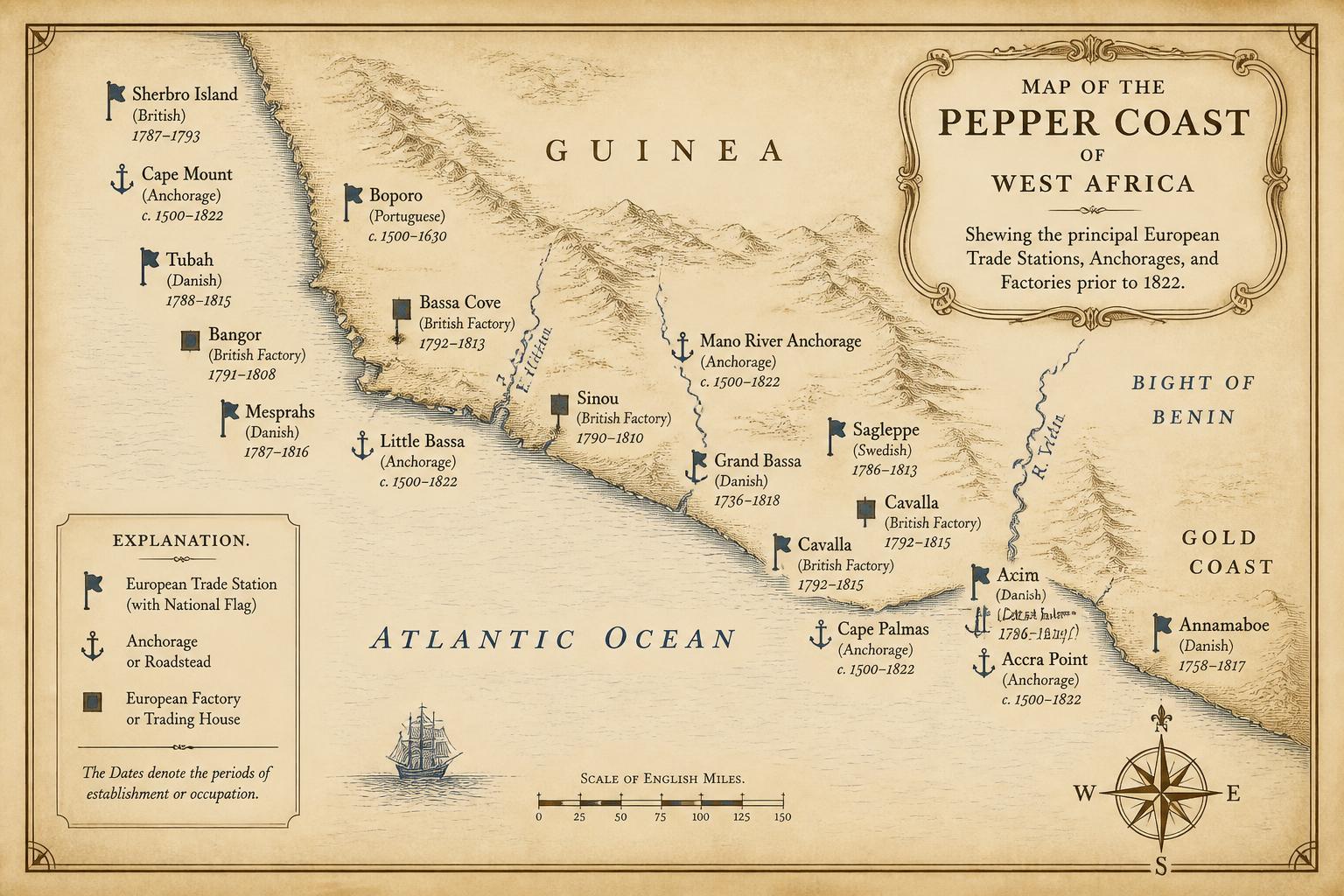
Map 12
European trade stations, anchorages, and factories before 1822
Points of contact along the coast, with periods of documented activity noted where sources allow.
Original cartography prepared for this volume.
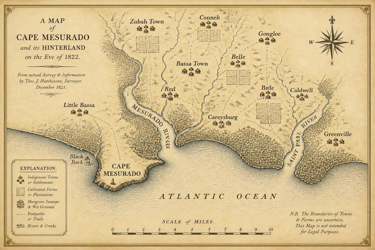
Map 13
Cape Mesurado and its hinterland at the moment of settlement
Towns, farms, and paths in the immediate vicinity of the Cape, reconstructed for the eve of 1822.
Original cartography prepared for this volume.
List of Figures
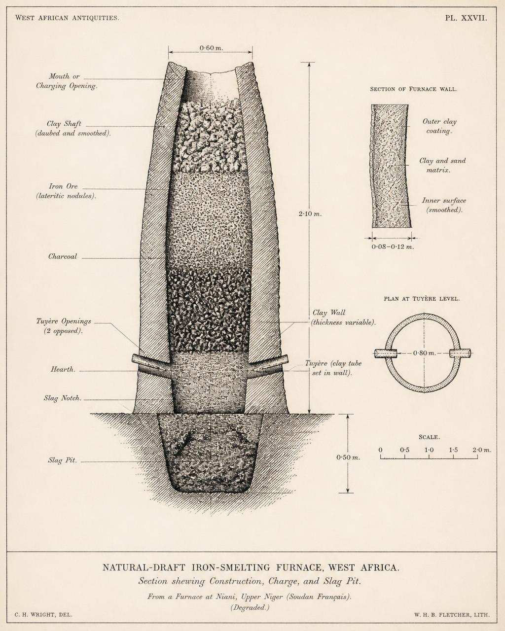
Figure 1
Schematic section of a natural-draft iron-smelting furnace of the forest type
Shaft, tuyère placement, and slag pit of the furnace type described in Chapter 12. Dimensions vary considerably between traditions.
View in chapter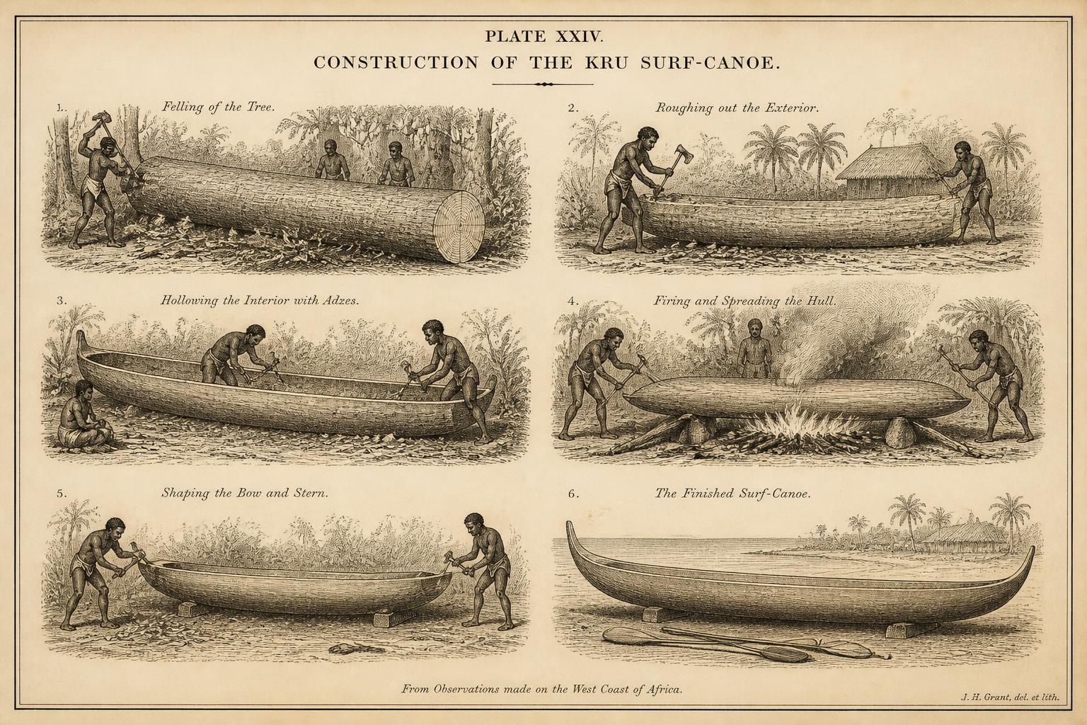
Figure 2
Stages of dugout canoe construction in the Kru tradition
From felled trunk to finished surf-canoe, showing the sequence of shaping, hollowing, and firing.
Original drawing prepared for this volume.
View in chapter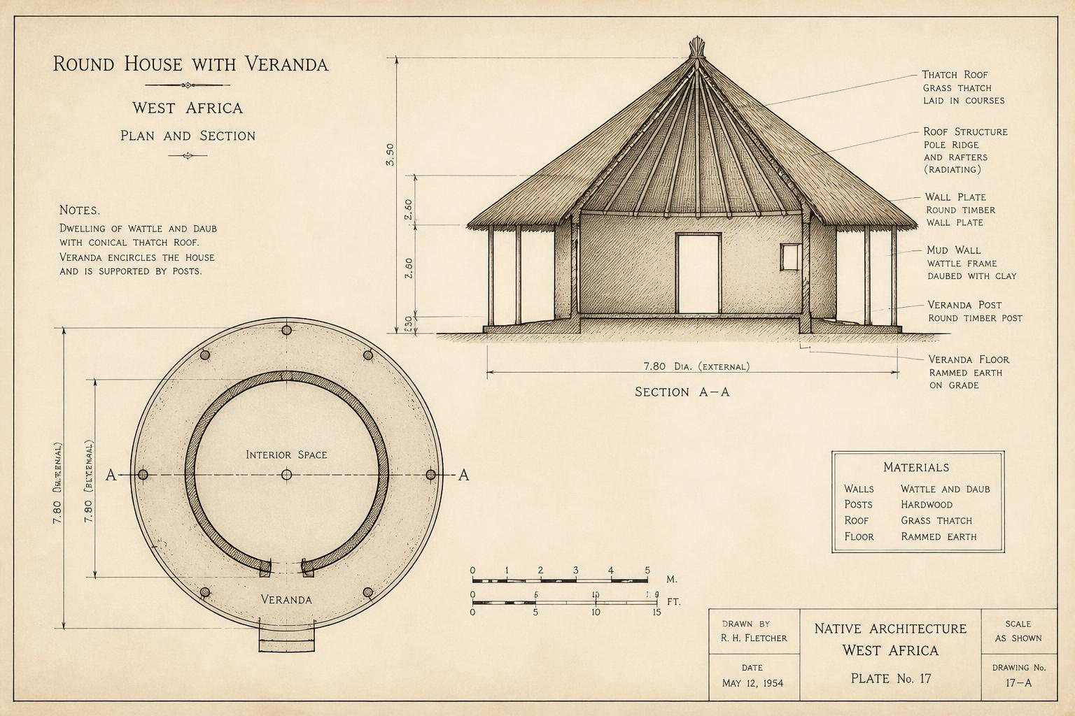
Figure 3
Plan and elevation of a round thatched dwelling with veranda
Construction of wall, plate, and roof cone in the forest building tradition.
Original drawing prepared for this volume.
View in chapter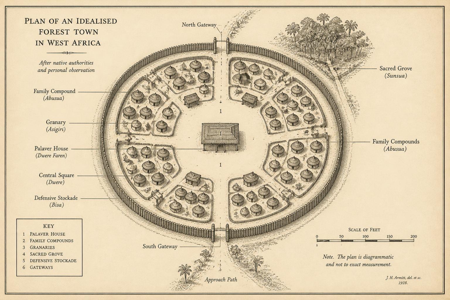
Figure 4
Town layout showing palaver house, compounds, and defensive perimeter
Idealised plan of a fortified interior town; actual towns adapt the scheme to terrain.
Original drawing prepared for this volume.
View in chapter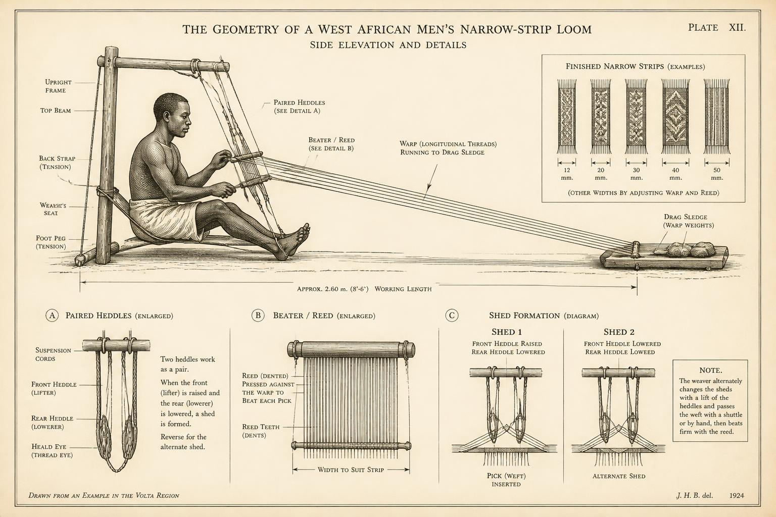
Figure 5
Loom geometry of the narrow-strip weaving tradition
Heddle, beater, and warp arrangement of the men's narrow-strip loom, with strip widths noted.
Original drawing prepared for this volume.
View in chapter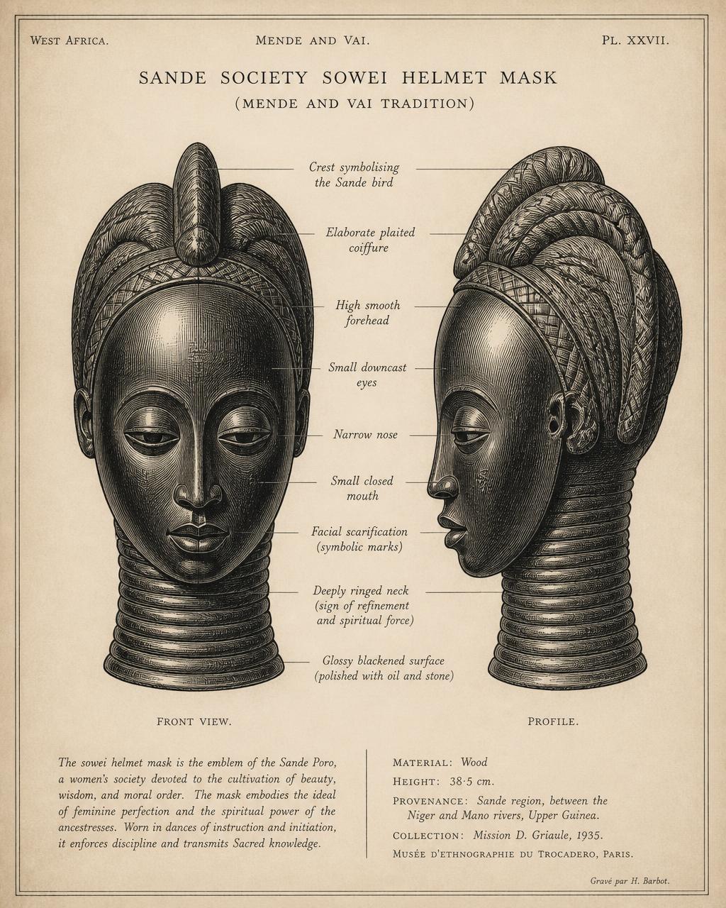
Figure 6
Sande society mask (sowei) — form and iconographic elements
Ringed neck, elaborated coiffure, and downcast features, with the elements named in the aesthetic vocabulary discussed in Chapter 17.
Original drawing prepared for this volume.
View in chapter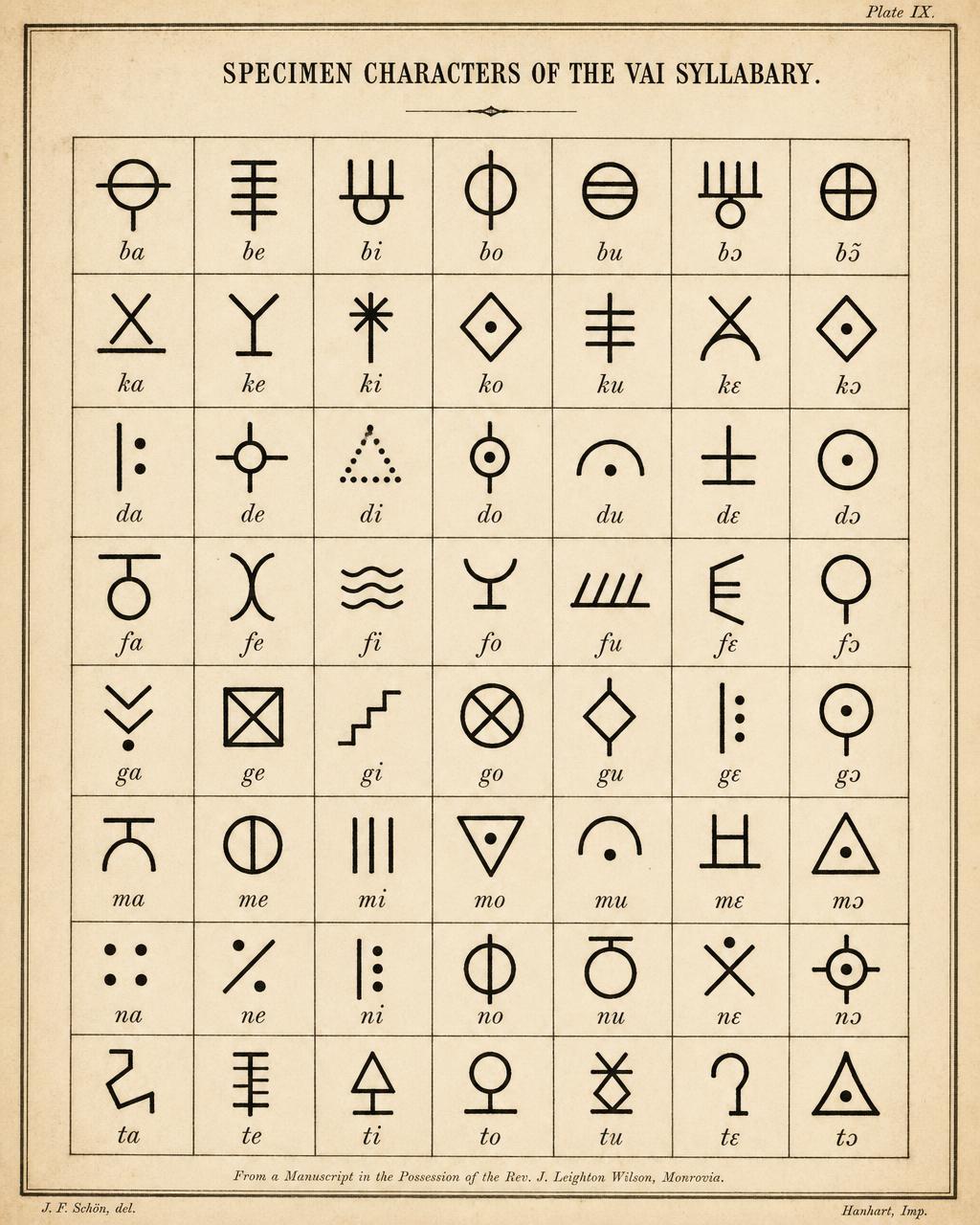
Figure 7
The Vai syllabary: selected characters and their values
A sample of characters with transcribed values.
View in chapter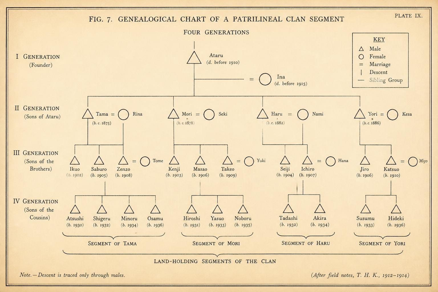
Figure 8
Genealogical structure of a patrilineal clan segment
Four generations of a lineage segment, showing the units through which land and office descend.
Original drawing prepared for this volume.
View in chapter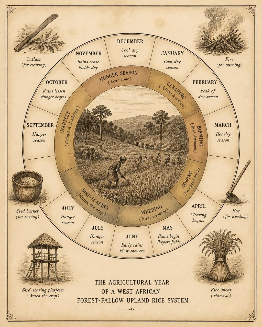
Figure 9
The agricultural year in a forest-fallow rice system
Circular calendar of clearing, burning, sowing, weeding, bird-scaring, harvest, and the hunger season.
Original drawing prepared for this volume.
View in chapter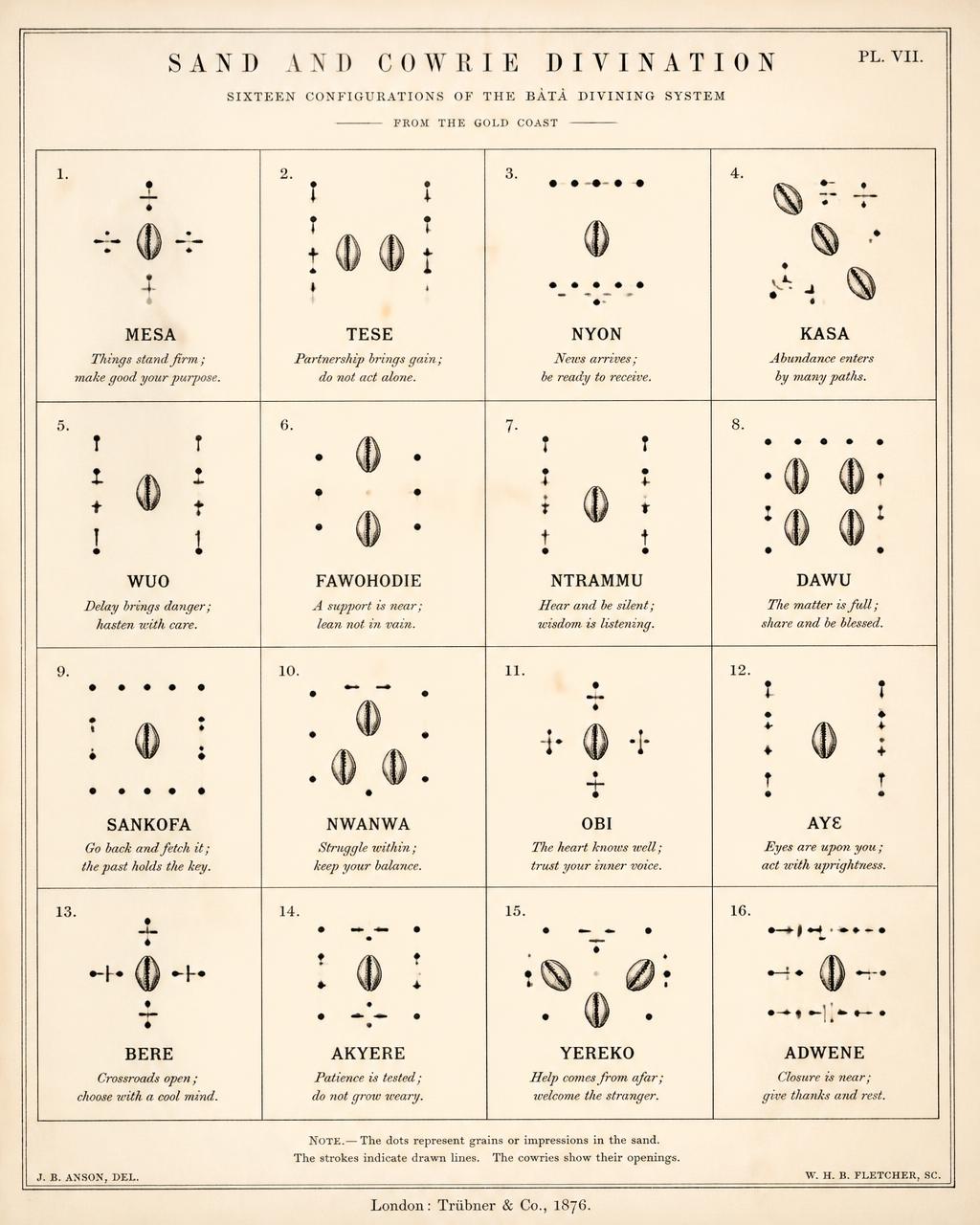
Figure 10
Divination configurations and their reading conventions
Selected configurations with the readings attached to them.
View in chapter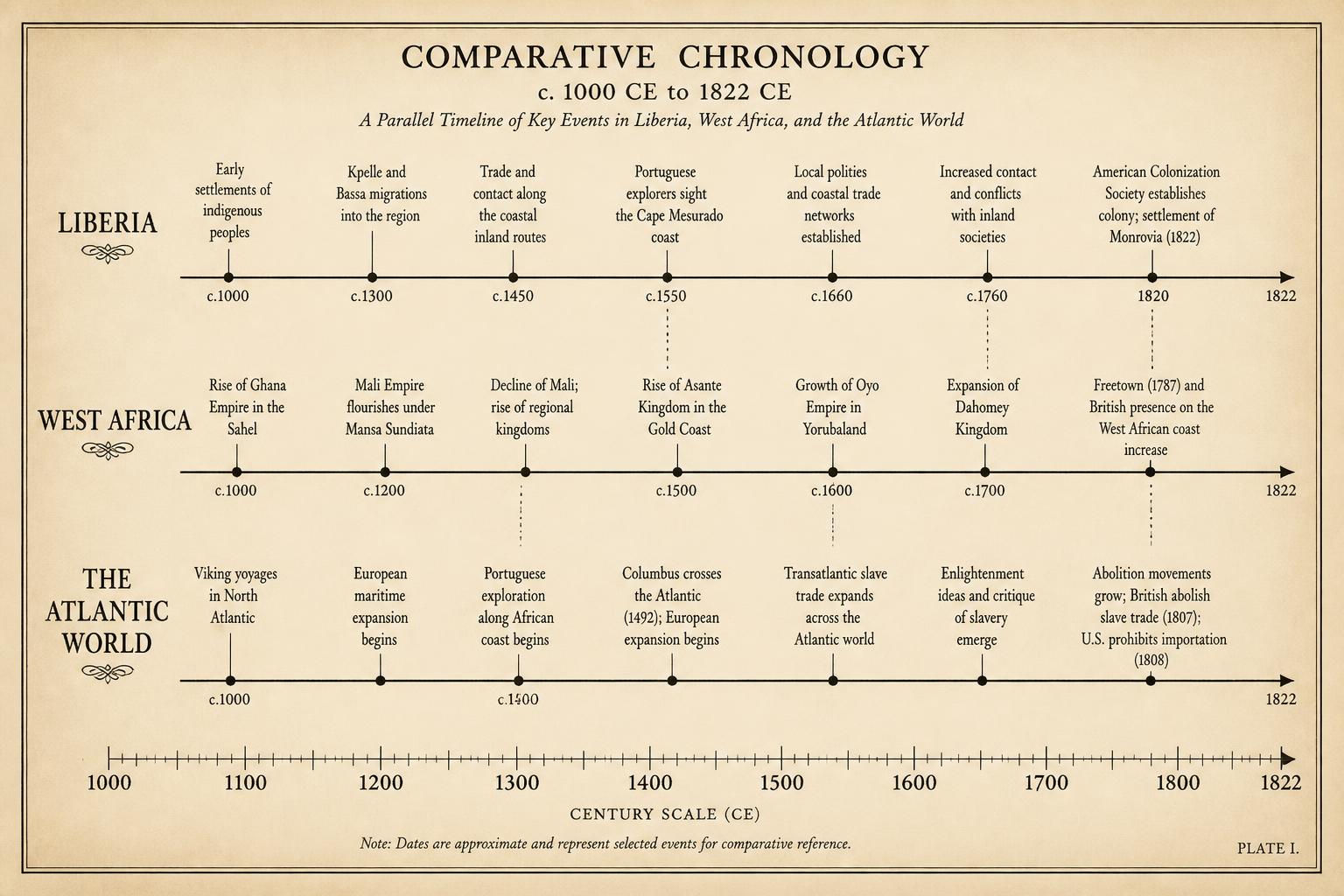
Figure 11
Comparative chronology: Liberia, West Africa, and the Atlantic world
Parallel timelines from roughly 1000 CE to 1822.
Original drawing prepared for this volume.
View in chapter