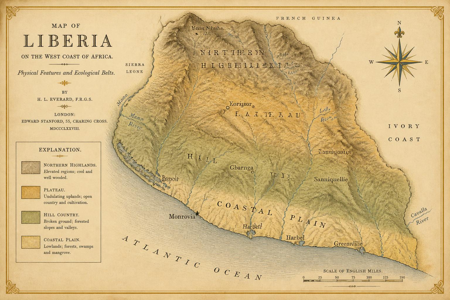
Map 1.Physical Liberia: relief, drainage, and the four ecological belts.Relief and drainage of present-day Liberia, with the coastal plain, hill country, plateau, and northern highlands distinguished. Belt boundaries are gradients, not lines.Original cartography prepared for this volume.
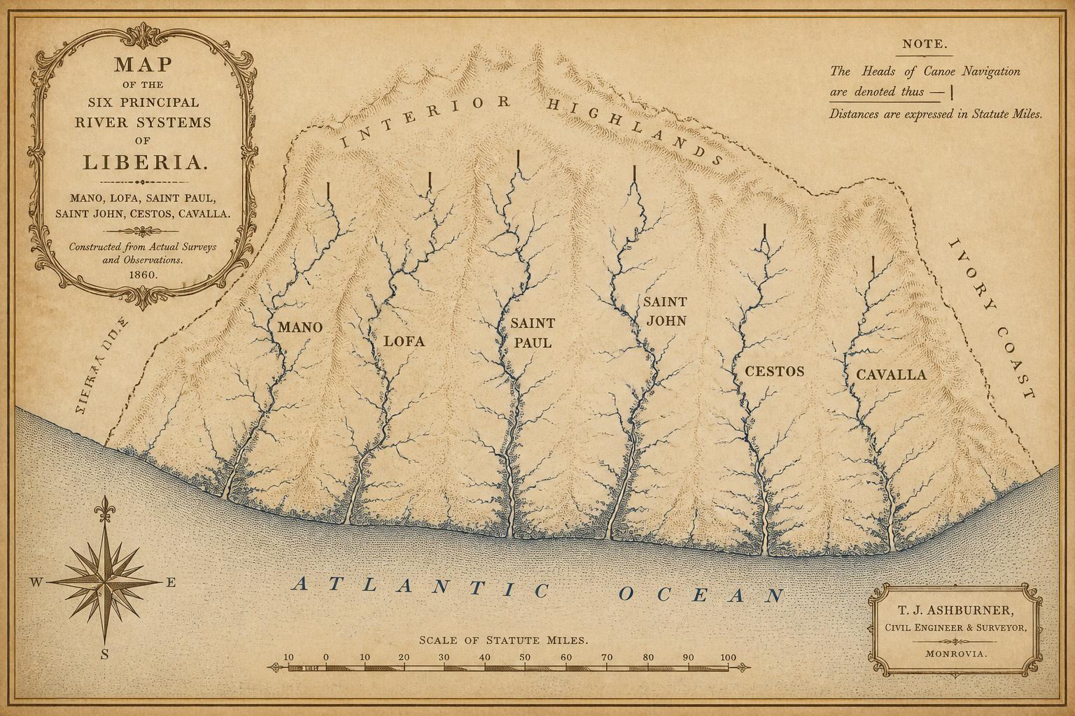
Map 2.The six principal river systems and their navigable reaches.The Mano, Lofa, Saint Paul, Saint John, Cestos, and Cavalla, with the approximate head of canoe navigation on each marked.Original cartography prepared for this volume.
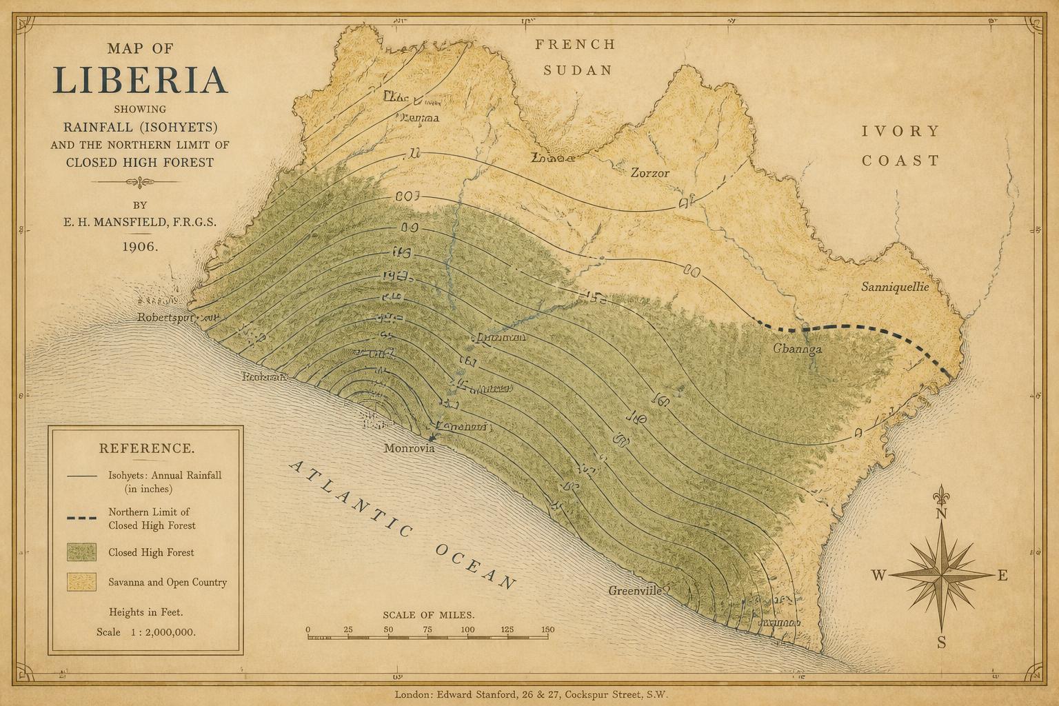
Map 3.Rainfall and the forest–savanna transition.Isohyets of mean annual rainfall against the northern limit of closed high forest.Original cartography prepared for this volume.