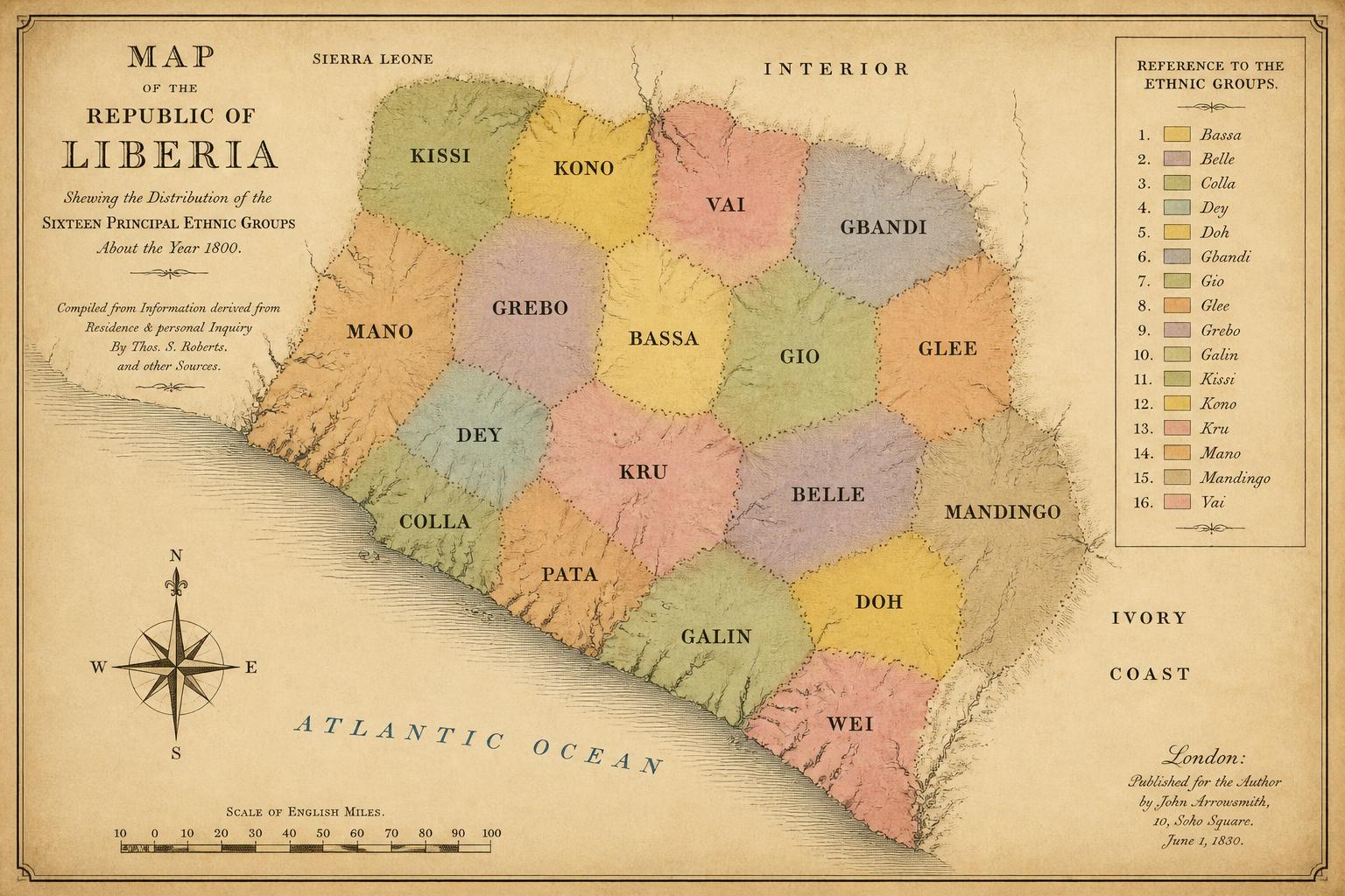
Plates in this chapterMap 7. Ethnic distribution, approximately 1800. Sixteen principal groups shown at their approximate early-nineteenth-century extents, before the coastal disruptions that followed 1822.Original cartography prepared for this volume.